
This is a sort of cross between a book review and a holiday post. I’ve just been in the Isle of Man for a fortnight, a period which I intended to spend walking, reading, and writing. For assistance with the walking part I made use of Terry Marsh’s Walking in the Isle of Man, which contains forty walks to cover the whole country. This is the most recent edition, published earlier in 2023. It starts with a little bit of historical, geological, and logistical information about the country, along with a few wildlife notes. I don’t think this would be enough to satisfy anyone going to the Isle of Man to birdwatch or explore historical sites – though I assume anyone in that category would do further reading – but I did find the information about public transport and so on very helpful. The bulk of the book is set out like any other walking book, with an excerpt of the OS map (route marked in orange), instructions that are either more or less helpful depending on the route, and a few pictures to let you know what to expect. It’s designed to be used either with the OS Landranger (1:50 000) or the locally-produced Outdoor Leisure: North and Outdoor Leisure: South maps (1:25 000). I opted for the latter, which I think was a good shout on some of the more confusing walks.
(I did have a moment before the trip, as I was perched on my sofa with a big backpack next to me, maps spread out all over the table – happily circling routes, using different highlighters for inland and coastal, cross-checking between guidebook and map – when I realised that I have become my father. Still, Dad has many worse qualities than “likes walking”, so as long as I can stick to this one it’s not so bad).
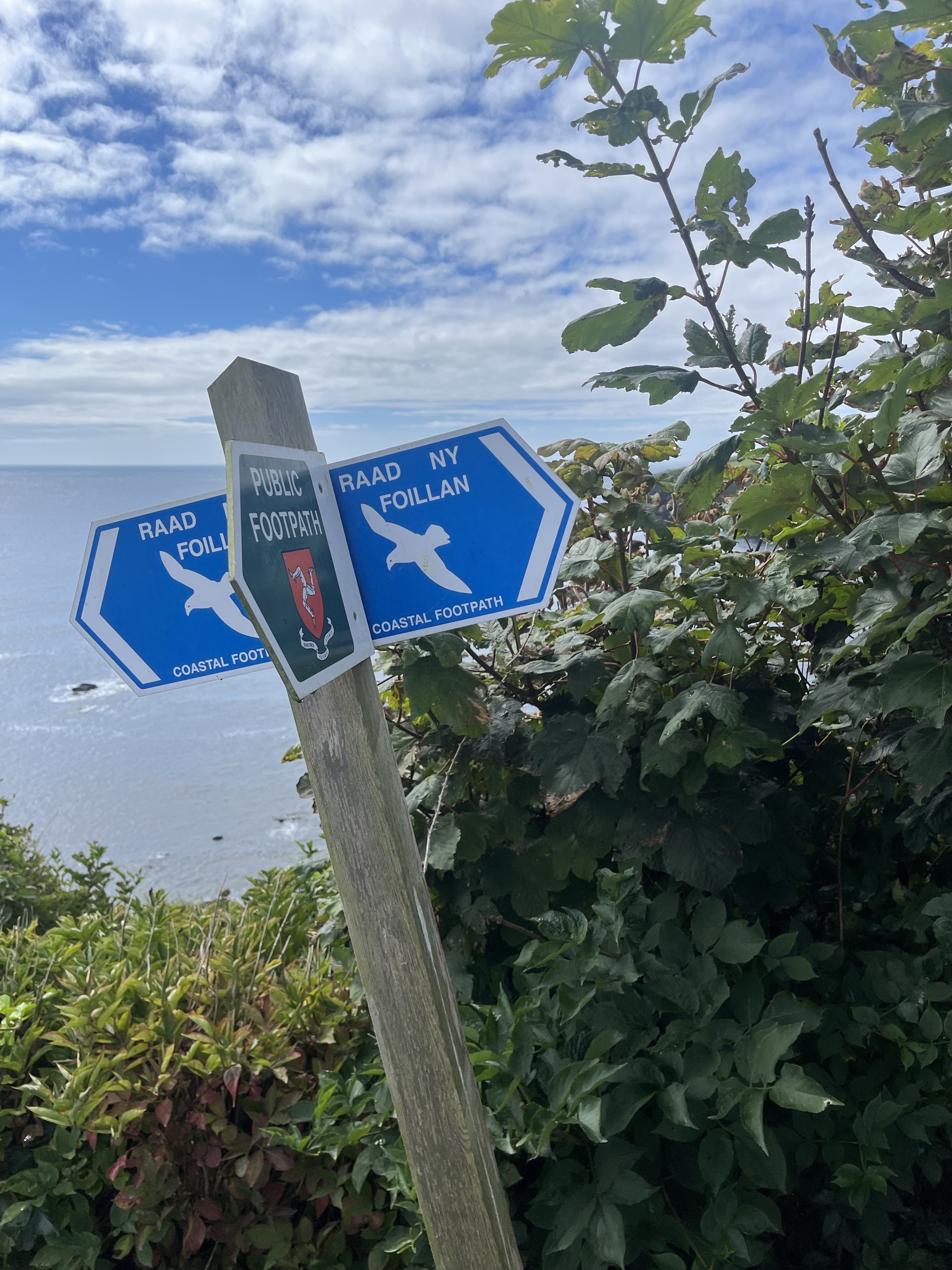
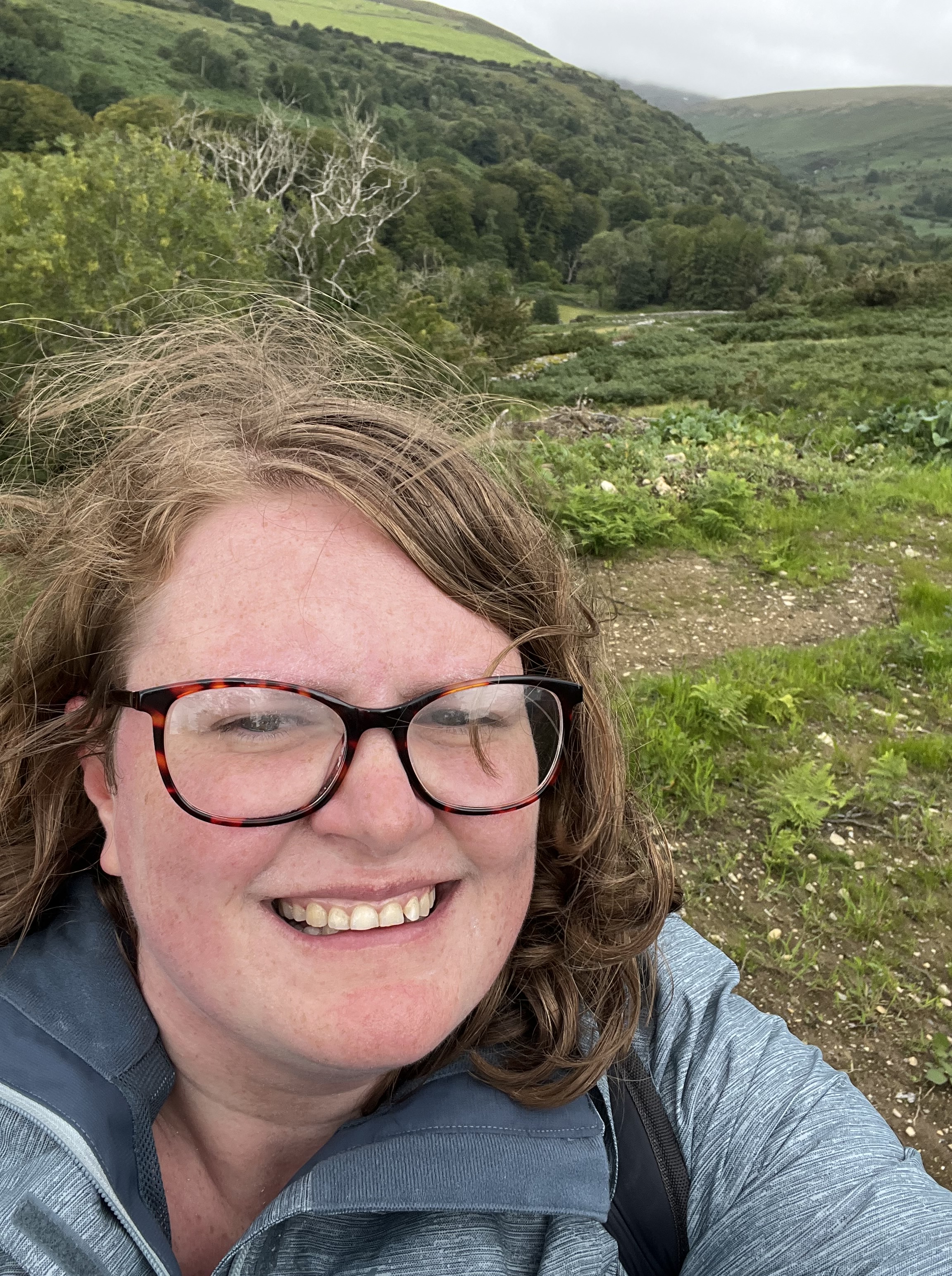
When I’m on my own, I’m mostly a fair weather hiker. I don’t mind some drizzle or a bit of breeze, and of course if you’re walking in the British Isles you must always be ready for any weather condition at all to materialise irrespective of the date. If it’s foggy or raining heavily, though, I won’t set out in the first place. If you’re solo hiking, it only takes one turned ankle to make the whole experience significantly less fun. I’m therefore very grateful that I decided against hiking the Raad ny Foillan, the coastal path that winds round the whole island, which would have required me to walk 8-12 miles a day. I was very tempted, and only opted out because I couldn’t get accommodation at all my stops (carrying a tent is another thing that turns walking from a pleasure into a chore), but it turned out for the best. There were several days of very heavy rain and wind while I was there, especially the first week, and I spent them happily exploring museums or reading in coffee shops. Anyway, I return from my adventures windswept, even more freckled than usual, and full of queenies and kippers – and without having fallen off a cliff or into a river. Over the course of the fortnight I spent there, I did manage a few of the walks in this book on the nicer days, and did another couple in part. I thought I’d share my favourites.

34. Port St Mary to Port Erin via the Sound
This is actually a stretch of the Raad ny Follian, winding round the coast between two seaside towns in the southwest via the Calf Sound, a strait that stretches between the mainland and the much smaller Calf of Man island. I did this walk early in my trip and it was easily the most challenging route I did, but it was hugely rewarding – as you can hopefully see from the pictures.


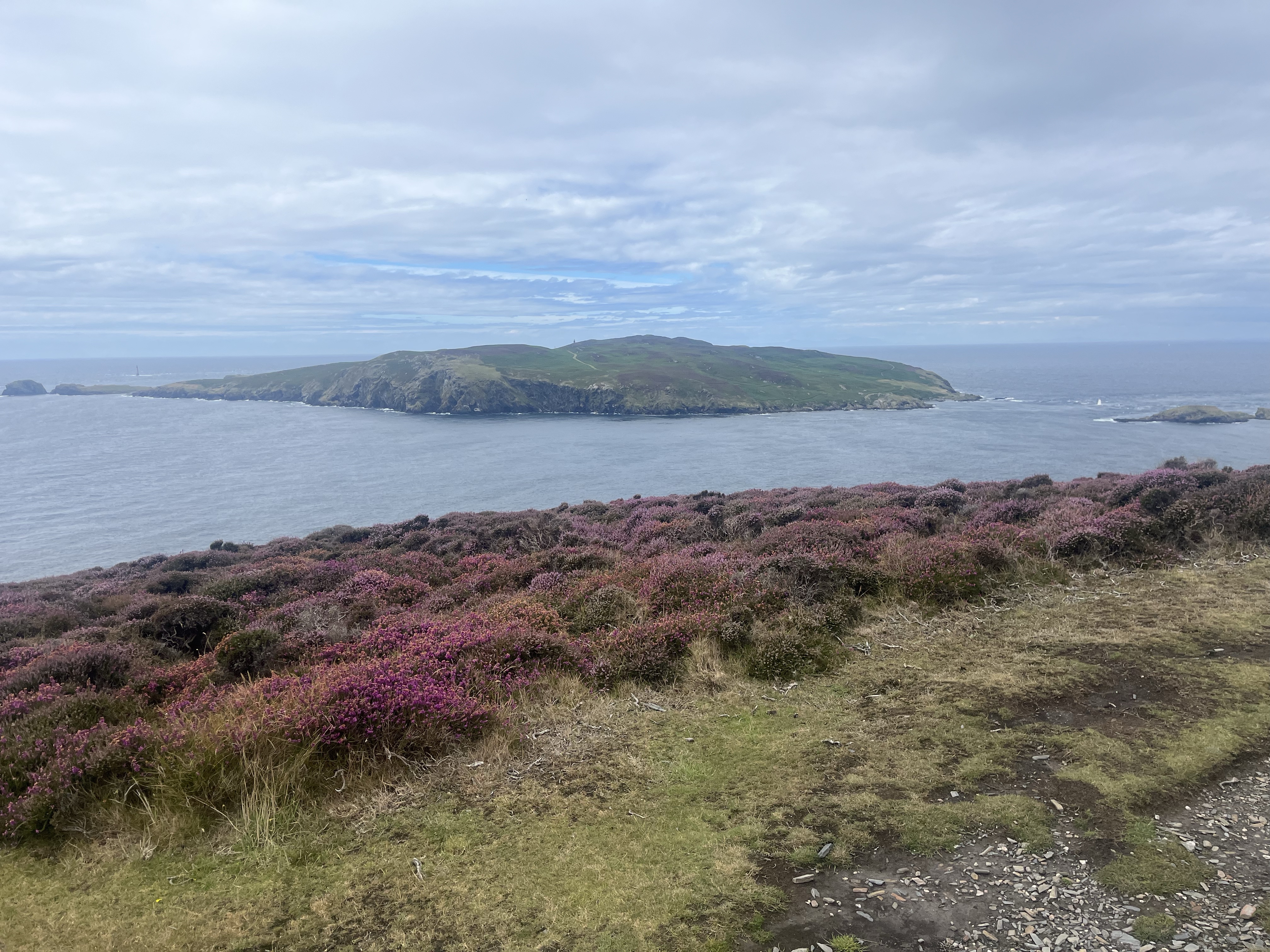

I would however like to point out that, according to the guidebook, this is only meant to be 11km – at the end of the hike, my phone told me I had walked 22.1km! At one point, I did have to double back as there was a very sheer scramble (another thing I won’t do on my own due to the risk of turning my ankle. Look, it took literally years for it to stop hurting last time I broke an ankle; I’d rather not do it again). I then followed a slightly different route until I joined back up with the clifftop path, which probably added around 2km to the walk in total, but I don’t know where the rest of the discrepancy came from. Anyway, it’s a lovely walk and highly recommended, but it will talk you the whole day and it’s much steeper than the book says. Do not do this walk with children and/or dogs, unless you are very, very sure that they will do what they are told when it really matters. In places, the path is both very narrow and very close to the cliff edge.
When I finally got to Port Erin, I was extremely glad to get chips and half a bitter at the pub. (Originally, I tried to order stout, but the barmaid looked at me as though I’d actually said “I’d like to drink half a pint of neat poison, please”. They didn’t even have Guinness. Baffling). I checked every route I did against the map before setting out after this!
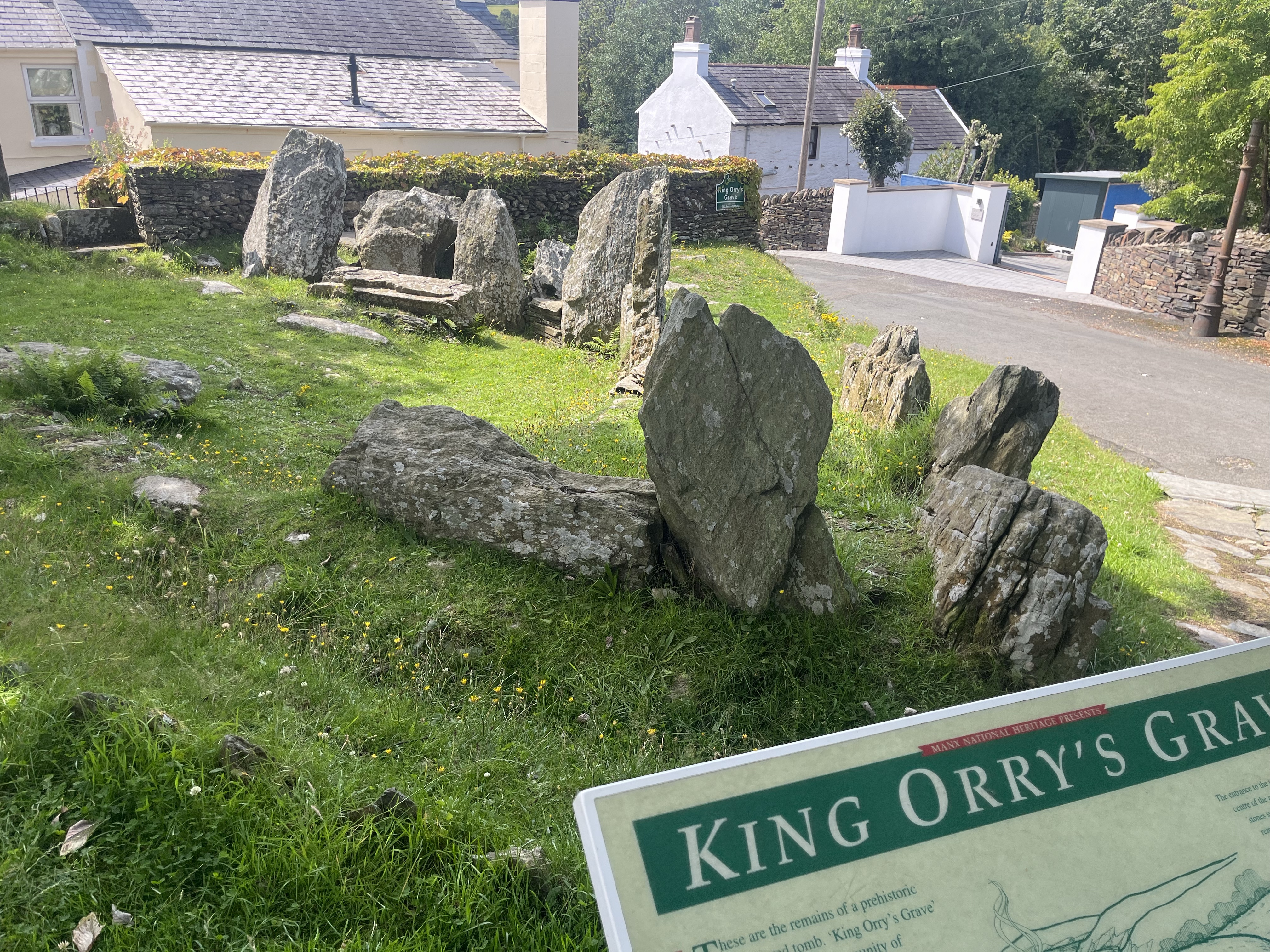
15. Laxey, Agneash, and King Orry’s Grave
Laxey is the site of one of Man’s most famous tourist destinations – the Great Laxey Wheel – but although I passed it a couple of times, I never actually went to see it, preferring to use it as a starting point for a walk. There’s more road walking in this than I realised when I was planning it – the “track” described in the book (and recorded on the map) for the last long stretch is much closer to a road than a track. On the other hand, in the past couple of months, a new footpath from just above Laxey up to Agneash has opened, so I was able to skirt some of the road walking at the start. There are absolutely stunning views of the surrounding hills when you get up to Agneash. It’s a steep climb – even the guidebook grudgingly admits to this – and I’m glad I did it on a grey day, because I think I would have been very hot by the time I got to the top otherwise! On the way back, I went to see King Orry’s Grave, which is a neolithic tomb about 4000-5000 years old (and split across two sites with a modern cottage in between!). The road section at the end got a bit tedious, if I’m honest, so I’m glad I had something interesting to visit.

17. Groudle Glen and Baldrine
I think this lovely walk might have been the highlight of my whole trip – and not just because it was less steep than any of the other walks I did. If you get the tram, you make your way from Groudle station through the glen and alongside the brook to get to the official starting point. The walk then makes its way to Baldrine up a very quiet country road, and winds back via the Ballanette Nature Reserve in a sort of lassoo shape, taking in the lovely Old Lonan/St Adamnan’s Church en route – where there appears to have been a church since around the fifth century AD (not consistently – the Vikings tore it down – but it was rebuilt about a century later). The stone pictured is a pre-Viking Celtic cross still in the cemetery.


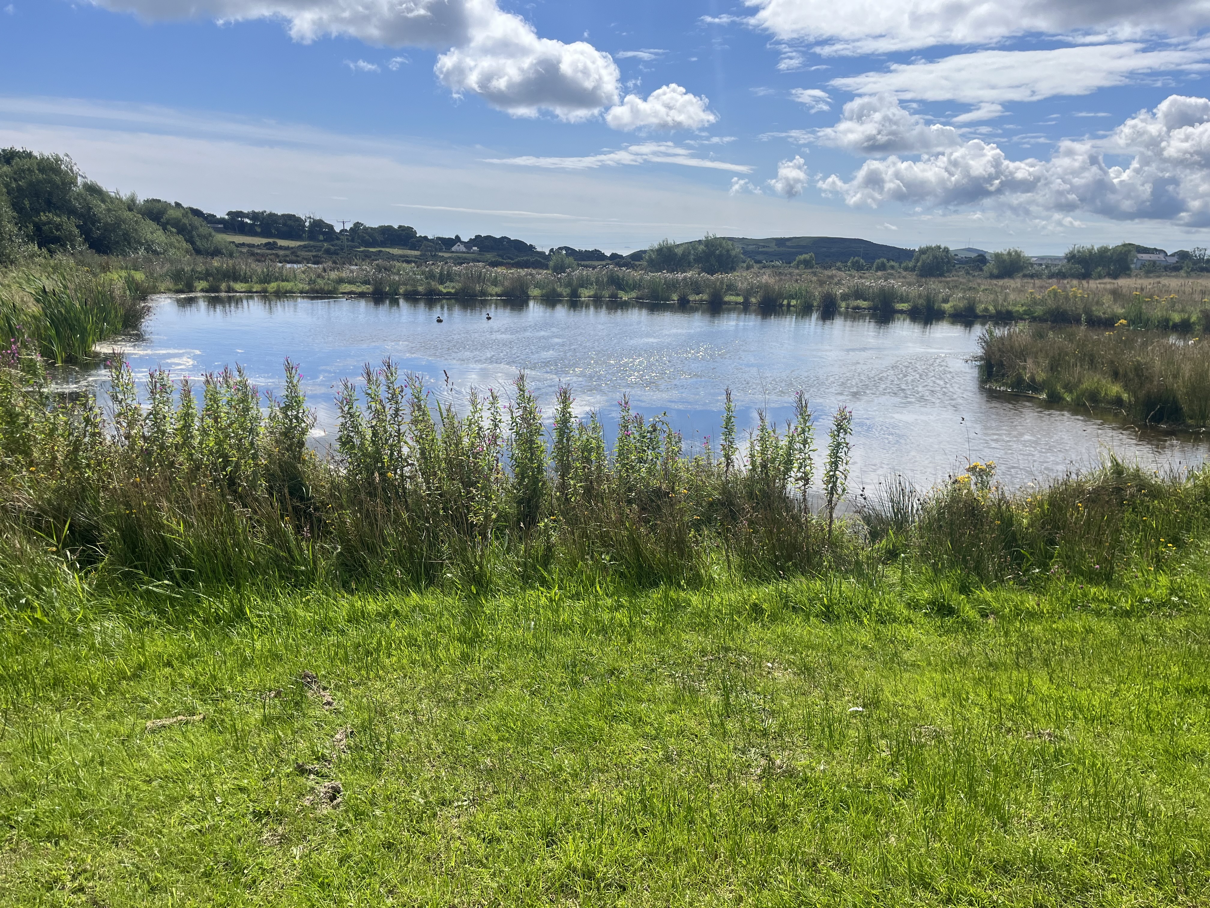
The nature reserve is a beautiful place, starting on the cliffs with incredible views out over the hills, and working its back alongside various small lakes and large ponds. It made for a fascinating contrast with the area around Groudle, where the trip starts and ends. All the signs in Groudle had very strong “keep orf my land, peasants; if you must use the path that the government have forced me to put in, then on your head be it; you do so AT YOUR OWN RISK and if you die it won’t be my fault” energy. (Groudle Glen is also the site guarded by that imposing wizard). Ballanette, in constrast, was remarkably welcoming. It manages a good balance between occasionally giving information about the local wildlife and not intruding on the tranquility and remoteness of the area. (Also, it has at least two free drinking water taps, so I was able to fill up my bottle. For this I was grateful). It cuts across a farm, so there are areas closed off, but the overall atmosphere of the place is so hospitable.
(Rather unfortunately, the pub where I’d planned to have lunch had in fact closed down, and I couldn’t find anywhere else to eat or even a shop to buy a sandwich in Baldrine, so I feasted on a squashed cereal bar from the bottom of my backpack and a handful of very early blackberries from the hedgerow. I have been privileged to eat in some excellent restaurants over the years, but if they’ve invented any food that tastes better than a battered cereal bar and a handful of blackberries after climbing hills all day, I have yet to try it).
Dhoon Glen
Ironically, this very short walk was the one place during my trip where I had a close shave with a nasty accident. I placed my foot awkwardly on the way down to the beach and skidded right to the edge. I’m very glad I was in hiking boots and not trainers, as they definitely kept me from re-breaking my ankle and quite possibly kept me on the path altogether. It would have been a very long and painful drop over the side! All the locals I saw walking here – at least all those who were thirty or older – had poles, and I think the book really undersells quite how steep and slippy this is in places. Perhaps this was in part an artefact of how much it had been raining, but even in perfectly dry conditions I think it would have been a challenge.
It was, however, all worth it when I got down to the beach. This is much more my kind of place than the sandy expanse of Port Erin. When I sent my mum the pictures, she said it looked like Criccieth, which we often visited during holidays when I was small. This part of the island did remind me very much of North Wales, with beautiful springy turf underfoot, burns and waterfalls everywhere, and heather and gorse on the hills. I spent a very happy couple of hours here reading and watching the sea. If there hadn’t been a gaggle of scouts on the other side of the beach, I might even have been tempted to go for a dip.


On the way back, I missed my way and ended up having to climb all 190 steps. In a couple of places I had to go on all fours because it was practically upright. Thankfully I ran into a local lad and he put me back on the right path to the station! Unlike most of the areas I visited, I didn’t find this at all well signposted (and because there are several paths running very close to one another and crossing over each other, it’s difficult to follow on the map). Since there are parts of it that are closed off at present, the lack of signs feels like a real oversight. Still, it’s a beautiful walk – the waterfall in particular is just stunning, and I spent a very happy couple of hours reading at Dhoon beach and looking in the rockpools. Just don’t be fooled by the short distance into thinking it will be easy!
In sum – should anybody fancy a fortnight in the Isle of Man, I heartily recommend it! Just bear in mind that this book isn’t a substitute for a map. I would definitely not recommend it unless you are confident using a physical map; there is no signal for long stretches of all these walks, and while most of the walks have signposts, in some places they’ve been broken off. Distances aren’t always accurate, and sometimes there are in fact not refreshments in places where there are supposed to be refreshments. That said, walkers are such a lovely community. When I doubled back to the Sound on that first hike, I had intended to walk into Cregneash and get a bus back to Douglas from there, but I met a couple who told me about the alternative, less scramble-y route, so I was able to make it all the way to Port Erin. (In turn I told them about the bus from Cregneash, since they had been hoping to get one at the Sound and that only runs at weekends. I ran into them on the Douglas bus from Port Erin, so they obviously made it in the end!).


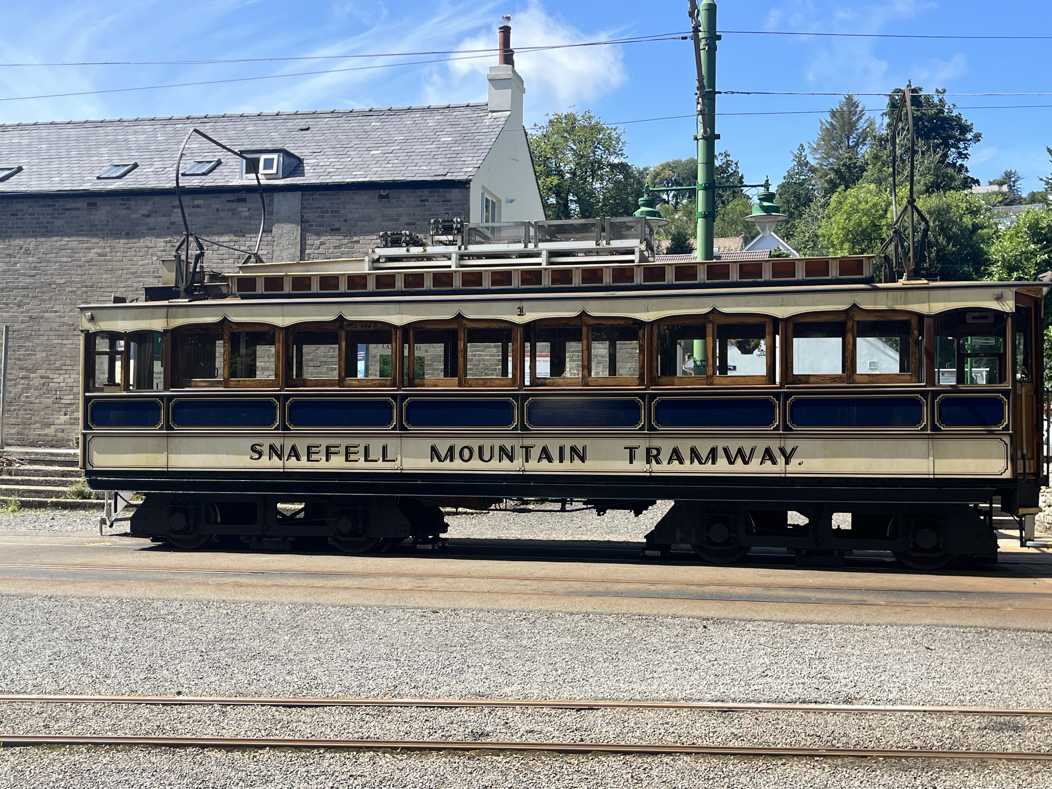
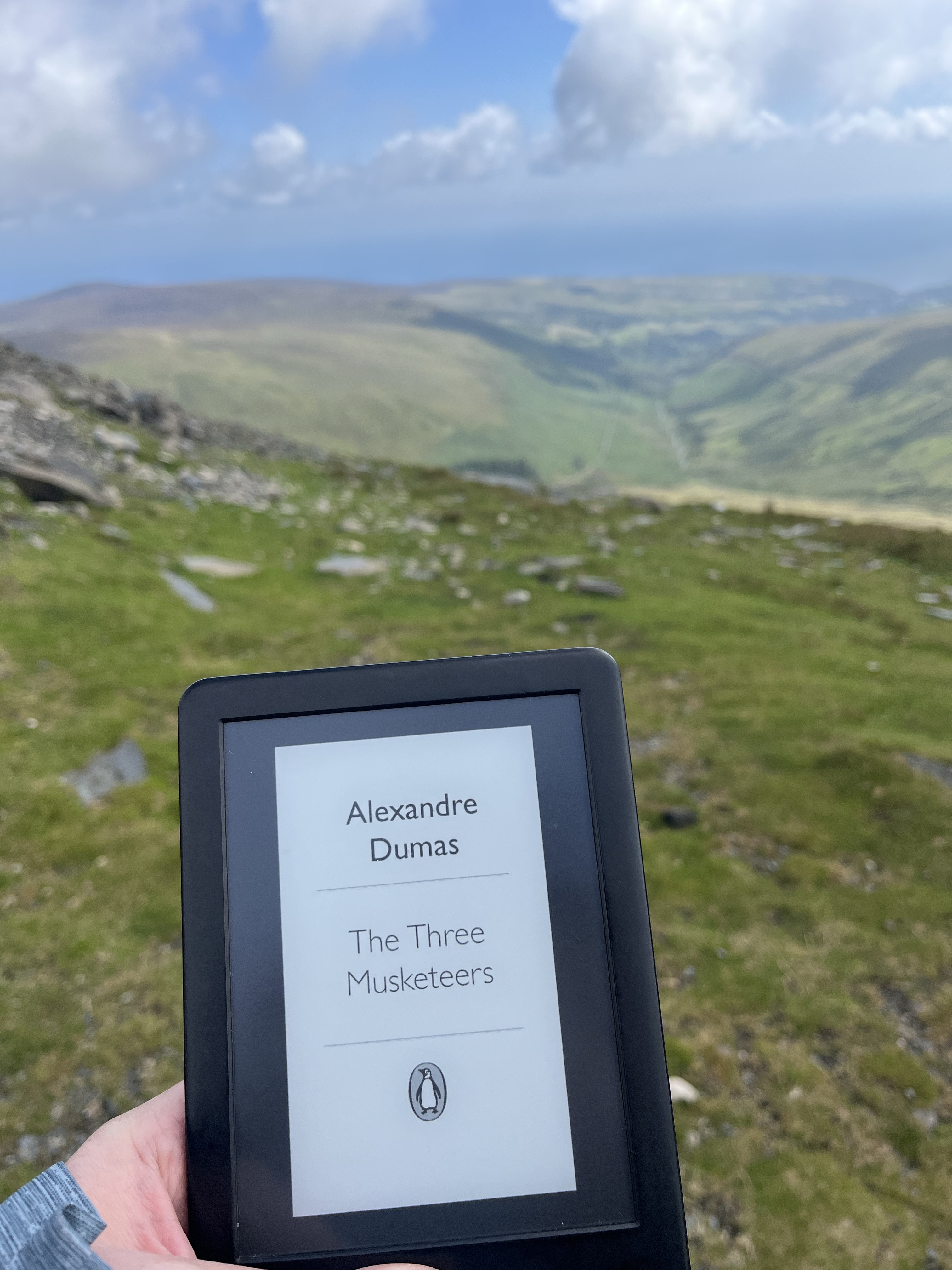
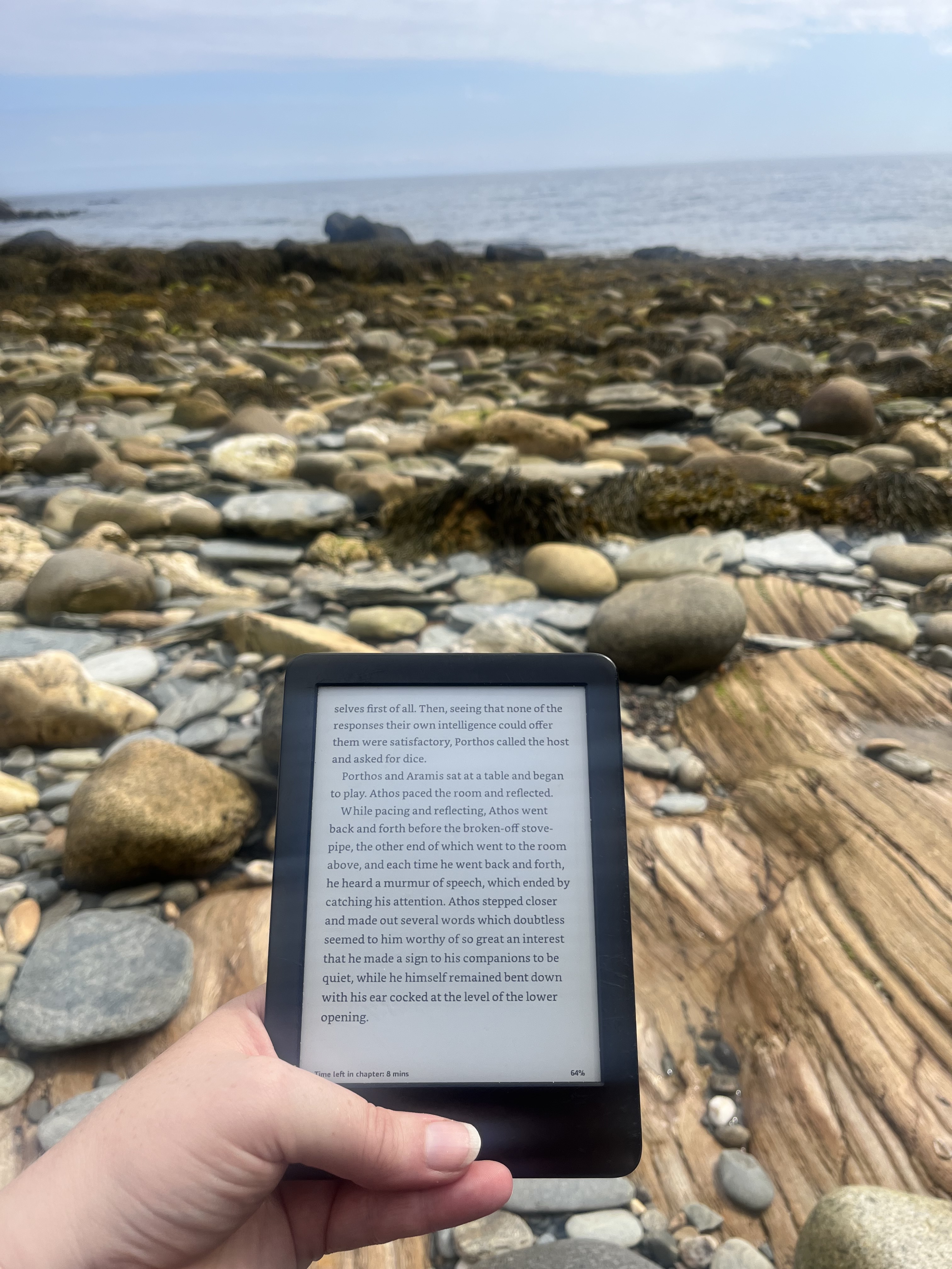
I did plenty of other things, of course – rode on heritage railways to my heart’s content (often surrounded by elderly train enthusiasts in kagouls, who seemed delighted to see someone under forty taking an interest and were eager to provide me with Unmissable Steam Train Journeys of the World recommendations. They were collectively appalled that I have never ridden the Watercress Line, which is practically on my doorstep); ate a great deal of ice-cream (should anyone be visiting the Isle of Man, the marketing hype you see about Davison’s everywhere really is true); clambered all over Peel Castle on a very grey day and climbed Peel Hill on a slightly brighter one; drank lashings of ginger beer, as is appropriate for any walking holiday; and read The Three Musketeers almost everywhere I went.
Next year I’m hoping to go to the Isle of Arran for more walking, reading, and writing – but I had a really wonderful time in the Isle of Man, and I will definitely be back to do some of the walks I didn’t get to on this occasion. It turns out to be very difficult to get both to and around the northernmost parts of Man without a car – there is some peculiar minibus-booking system that I never entirely understood – so if I were to go again, I think I would divide my time between Groudle, Peel or Port Erin, and maybe Jurby or Bride or another area in the north of the island, so that I would be able to do those walks as well – this year I never got north of Snaefell. A lovely trip, in short (or rather, in long) – but I am very glad to be home. The little hill on my walk to work feels like nothing after all that hiking!

That’s a peril we all face, becoming our fathers, which we must each resist as best we can.
I’ve never walked anywhere in my life, not even in boy scouts for any great distance. So good on you. And thanks for taking us with you. Did you talk to anyone in the 14 days? You don’t say. I often go that long without saying more than a few words as I pay for my fuel – and lots of those are unmanned.
Admittedly I might not have become such a keen walker if I had grown up somewhere as hot as Australia, or as full of potentially alarming wildlife. The scariest thing I am likely to encounter on my adventures is a bull, and those are normally enclosed in fields with big warning signs.
I talked to the people I met out on the footpaths. Walkers all talk to one another, despite the stereotype of Brits not being very social. And I was staying at a B&B, so I talked to the landlord and other guests every morning. That was a mixed blessing – there were a lot of very strong and unpalatable opinions about asylum seekers, which is a lot to deal with before you’ve even had any tea, but there were a few friendly older men who had done a great deal of walking on the island and gave me some good advice about places to see (and places not to walk alone because of landslips).
Tasmania and the south-east and south west corners of the mainland – cooled by the Southern Ocean would seem to be very Englishy to me (I’ve only been to England for one day).
In WA you can walk from Perth to the south coast, 450 kms (or stages) on the Bibbulmun Track (Wiki says 1000 km so it must wind around a lot). My daughter and her husband have done bits of it. If you give it a try I’ll give you my phone no in case you need rescuing.
And no wild animals! (if you’re sensible about snakes and spiders).
Tempting! I looked up the Bibbulman Track and the photos are beautiful. Something to bear in mind if I ever make it to Australia!
Your thread with Bill ran out of the ability to have more comments, so I will say I’m glad it’s not just us Americans who are worried about all the wildlife in Australia!
You truly are like a hobbit, dear Lou! Lots of walking, coming into danger, wondering where the food is that you were promised.
This also serves as an excellent book review. It sounds to me like this “updated” 2023 guide needs to be throw in a fire pit. Honestly, double the km it said it would be? Steeper? No available food? That’s a great way to get someone seriously injured. You should send your thoughts off to the publisher. Maybe they’ll hire you to do research for the next iteration.
Oh no, the book was actually pretty decent. Anyone using one of these books should be aware that e.g. pubs can close down (it looked like it had been shut pretty recently) and I don’t know how much I actually added to the other route with the detour – not 11km, sure, but it might have been more than 2km. Plus for that walk I didn’t look at the map first – if I had I would have seen the contour lines, so I would have known how steep it was. It was irresponsible; I was just out of practice because it’s pretty flat round here. I do think the Dhoon Glen route is misrepresented, but I couldn’t do the full thing because part of it was closed due to track instability (again a recent change), so it’s possible that if I’d done the full route it would have had a gentler decline. The book’s designed for experienced hillwalkers who can adapt en route, and it makes that very clear from the start. I wouldn’t recommend it to someone who’s brand new to hiking, but neither would the writer!
It’s very funny to me that you describe these as hobbit adventures because walking is such a normal pastime here – I often go for walks with friends and no-one thinks anything of it. Even going on holiday specifically to hike isn’t that eccentric. I suppose it is very hobbity in the sense that Tolkien loved the English countryside and so do I! (Although Mann is not in England).
Ohhhh, wow, that’s so weird that a book can be an approximation, and that is what the experienced hiker expects.
If Americans go on a walk together, there is going to be some hefty coordination and planning, time off from work (which is actually switching shifts with other people because we don’t really get time off from work), and we’re going to be paranoid about all the ticks.
Well, I enjoyed vicariously joining you on your hikes very much! There is nothing quite so relaxing as reading about someone else doing lots of physical activity, I find… 😉 Glad you enjoyed yourself and got enough decent weather to let you do several walks.
Thanks! Yes, while I enjoy walking very much, I also definitely enjoy reading about other people hiking, while I am curled up in a comfy chair, preferably with some chocolate or a cup of tea.
What beautiful scenery! I’m glad you had a nice trip (and no broken ankles!) I’m fascinated by the walking holiday culture because it just doesn’t exist here in Canada. Do you sleep in different places each night or the same place for the 2 weeks and then head out on different paths each day?
It depends! I have done both – last time I did a walking holiday I slept in different places every night, but this time I stayed in the same place and used public transport to get to the different paths. If you’re doing one of the well-established long-distance routes in the UK, there are normally companies that will transport your bags from one stop to the next so you don’t have to carry as much. I’ve never done that, though I might be tempted if I was going to be walking every day for a fortnight. My preference would be to walk from place to place, but have a few rest stops where I stay in the same place for a couple of nights (allowing me to catch up on laundry and food shopping!). I think being in a fairly small country with good right to roam protection helps – you are almost always within a few hours’ walk from a decent-sized town here, so that makes it much easier than in a big country.
That sounds like a lovely way to spend a holiday. I’m fascinated by it because I feel like it wouldn’t be possible in most of Canada. You could walk in some directions for days and never see a person let alone a pub or a place to stay. Or if you were walking from one town to the next you’d simply be walking on a highway or something.